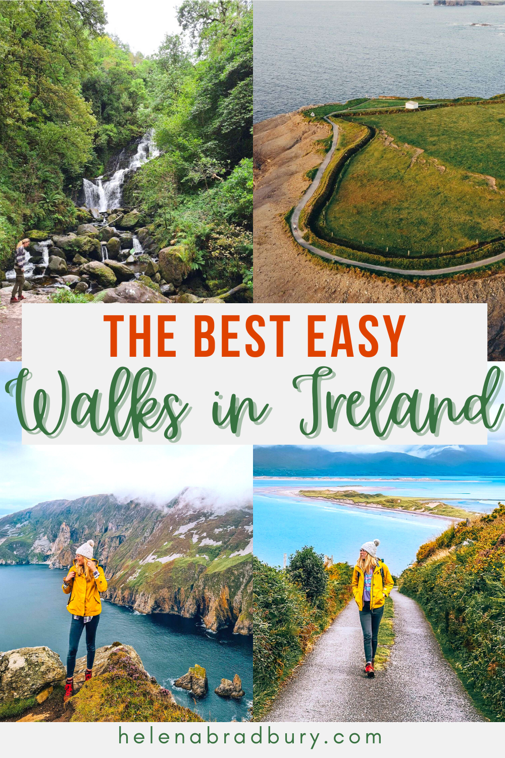
Ireland is famous for its outdoor attractions, hiking routes, mountains, dramatic landscapes and adventure activities.
But if you want to experience the best of Ireland outdoors without having to climb a mountain or endure challenging conditions, thankfully there are also plenty of easy walks in Ireland with rewarding views.
Here are 12 great easy walking trails Ireland has to offer. They’re located throughout the country, so hopefully there’s a walk here that’s perfect for you and your Ireland trip itinerary.
The best easy walks and easy hikes in Ireland with views
All of these walks follow well established walking tracks so there is very little chance of you getting lost.
The routes are well-travelled especially in the peak months in the summer and while there are short steeper sections in a couple of these routes, none of them are particularly challenging if you are of average level fitness.
Although as with any outdoor walking, hiking or adventure activity, please make sure you’re fully prepared with enough water, adequate walking shoes and clothing for the changeable Irish weather.
Make sure you have offline maps downloaded on your phone (or a paper map) just in case and always tell someone where you’re going, especially if you’re going out walking on your own.
Benbulben Forest Walk, Sligo
Benbulben forest walk view
Distance: 5.5km
Description: Loop walk
Difficulty: easy
Trail colour: red
Start Point: Benbulben Car Park (labelled as Benbulbin Walk on Google Maps)
Finish Point:Benbulben Car Park (labelled as Benbulbin Walk on Google Maps)
The Benbulben Forest Walk is a lovely loop walk which runs along the western side of Benbulben Mountain before looping around anticlockwise through the woods and ending with views of the coast and across the Sligo countryside.
The entire route is well-marked, mostly flat and on a gravel path. We just found the last stretch through the woods right before we returned to the car park became a bit muddy.
The unique shape of Benbulben was formed by glaciers moving and cutting the earth during the Ice Age. The mountain sits at 526m above sea level but even walking around the base, you have fantastic views of the surrounding areas as you loop back on the second half of the walk.
This is an ideal walk to add to your Sligo itinerary, particularly on a clear day, although as you can see from my photos, even with low clouds, the mountain still looks beautifully atmospheric.
Downpatrick Head, Mayo
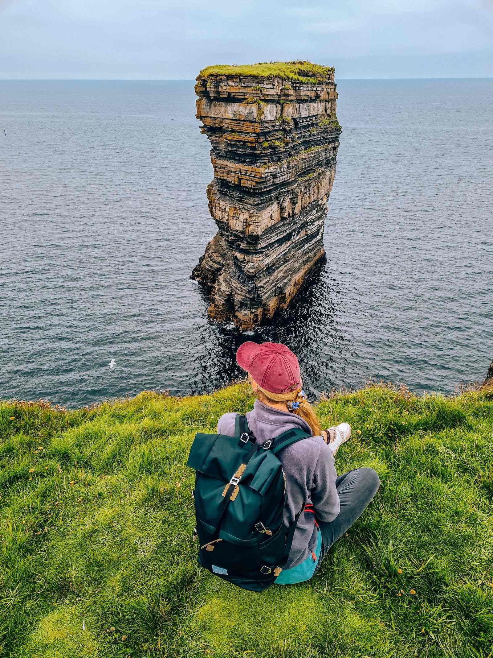
Downpatrick Head
Distance: 1.4km
Description: Loop walk
Difficulty: easy
Trail Colour: Green
Start Point:Downpatrick Head Car park
Finish Point: Downpatrick Head Car park
This is a super easy trail, clearly marked from the Downpatrick Head car park. Mostly flat but some uneven ground closer to the cliffs.
You’ll see the unique grass mounds at Downpatrick Head as you get closer to the cliffs. Once you’re at the cliff edge the route isn’t particularly marked but you follow the cliffs to the right and the shape of the cliffs naturally curve inwards and bring you back to the path back to the car park.
Downpatrick Head is not only an easy Ireland walk but it’s also one of the best cliff walks in Ireland, especially because it’s much less busy than popular spots like Cliffs of Moher. You’’ also see the iconic sea stack which stands a short distance off the shore.
Although Downpatrick Head is more on the map now after being the location for the Red Bull Cliff Diving in 2021.
A word of warning, the edges of the cliffs are unprotected and at over 50 metres above sea level, are incredibly dangerous if you get too close, particularly in bad weather or high wind. Keep children nearby and don’t sit on the cliff edges.
Downpatrick Head is a great addition to your Wild Atlantic Way itinerary in Mayo.
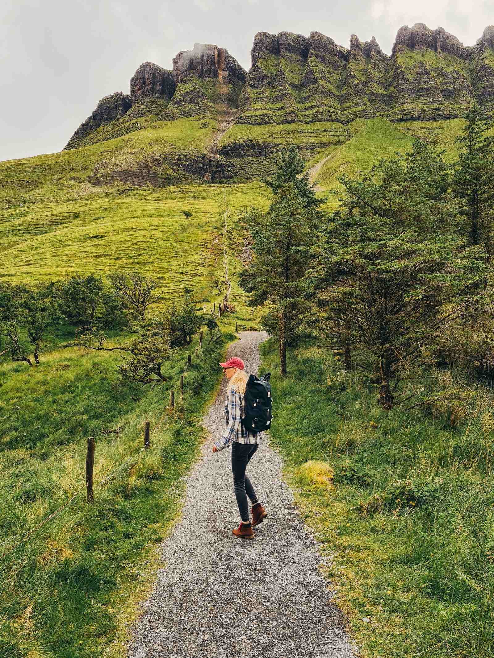
Keshcorran Caves, Sligo
Keshcorran Caves
Distance: 3km
Description: Out and back
Difficulty: strenuous - short sections of steep climb, can be slippery in wet conditions
Trail Colour: red
Start Point: Keash Church car park
Finish Point: Keash Church Car park
I’ve put the Keshcorran Caves on this list because, although I’ve marked it as strenuous, it is an extremely short walk, we got to the top in 20 minutes and back down again in 15 minutes.
The Keshcorran caves are definitely one of Ireland’s hidden gems and well worth a visit if you’re in Sligo, however I would only attempt this walk if the weather is and has been dry, unless you’re a well-practised hill scrambler!
The walk starts from the Keash Church Car Park which isn’t labeled on maps, however, you’ll find the location of the car park on Google Maps here and you’ll also see the start of the trail in the image, as well as the caves on the hillside.
The car park is relatively small with space for about 6 cars (if everyone parks well!) and as you can see from the Google Maps link, the caves are visible from the road.
You start by crossing farmland (so unfortunately no dogs are allowed on this trail) and then you follow a gravel path that snakes up the hillside and which becomes quite steep.
The gradient and loose gravel makes this a strenuous climb even when the weather is dry (which it luckily was for us) and I’d suggest taking a breather or two on the way up if you’re not used to hill climbing.
I would not usually recommend a hill climb if you’re inexperienced with them, but this one is so short that it makes it doable.
It goes without saying but good hiking boots or shoes with good grip are essential here.
Once you’re at the top, the views are incredible! There are 17 caves in total and you can wander in a few of them and see the views across Sligo.
The caves have been a great point of archaeological interest with human remains and animal remains found that date back to the Ice Age.
Slieve League Viewing Platform, Donegal
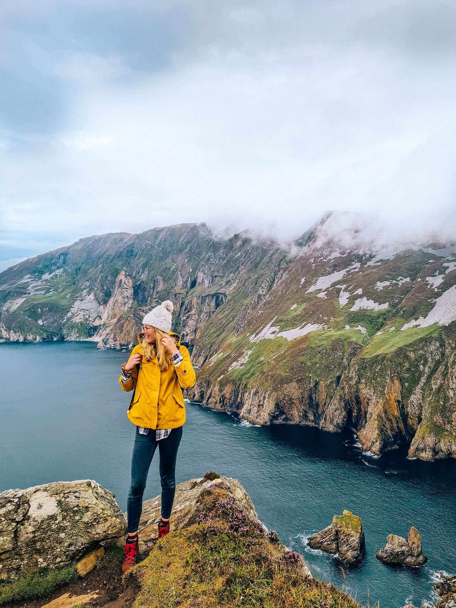
Slieve League
Distance: 3.5km
Description: Out and back
Difficulty: moderate, fully paved track to the viewing platform but steep in places
Trail Colour: N/A
Start Point: Slieve League Car Park
Finish Point: Slieve League Car Park
Slieve League is one of my favourite easy walks Ireland has to offer, that’s possibly because I didn’t know much about Slieve League and I did not expect such spectacular views!
Did you know that the Slieve League sea cliffs are the highest cliffs on the island of Ireland, at 595 metres, they’re almost 400 metres taller than the Cliffs of Moher (214m).
Slieve League is one of the best walking trails in Ireland because the initial walk to the Viewing Platform is very accessible.
I have actually read online that you can sometimes drive right up to the viewing point and park next to it because the road out to it is tarmacked and smooth.
However when I visited the gate was closed and guarded by a member of staff who told me that when it’s busy they require people to use the main, large Slieve League Car Park which is by the visitors centre, found here on Google Maps.
From the car park, it's a 1.7km walk to the viewing platform which takes around 20 minutes.
There is a short, steeper section of this road at the start but the whole route is tarmacked and winds leisurely through the cliffs along the coast until you reach the viewing platform.
It’s worth noting that there is another route - the Pilgrims Path - this brings you to the Slieve League cliffs a different way and is a more challenging route so do not follow signs for this.
Once you reach the viewing platform, you can enjoy the view of the cliffs from here, or if you’re feeling up to it, you can walk up and along the hill trail that follows the cliffs hiking route.
This route is of course more challenging the further you hike onto the cliffs, so perhaps do what we did and walk up the initial hill that’s above the viewing platform and enjoy the views, then head back down and start walking back. The more adventurous and well-equipped hikers may wish to continue on.
Diamond Hill - Lower Diamond Trail, Connemara, Galway

Diamond Hill
Distance: 2.1km
Description: Loop walk
Difficulty: easy/moderate - well marked gravel path, some occasional step sections, weather conditions could impact visibility
Trail Colour: blue
Start Point: Connemara National Park Visitors Centre
Finish Point: Connemara National Park Visitors Centre
When I mentioned the Diamond Hill Connemara hike to someone and said I thought it was one of the easiest hikes in Ireland, they were shocked and said they didn’t agree.
It turned out they had no idea that there are 4 trails here - green, yellow, blue and red.
Green being the easiest and shortest and red being the hardest and longest right to the summit of Diamond Hill. All four walks start from the same place, so it’s really up to you to choose which trail is best for you and your capabilities.
We did the Connemara Diamond Hill walk: blue trail, the 3rd longest which loops halfway up the Hill but cuts off the final ascent where things get a bit tricker - I have heard it is very doable with average level fitness on a good clear day but for us, visibility was low and we were short on time so we didn’t want to rush to the top in less than ideal conditions.
Thankfully all the trails are well-marked and the blue trail follows a path which is mostly gravel or stone the whole way.
The incline is gradual, there are no steep sections but there are sections with stone steps and these are uneven in places.
Once you reach the junction with where the red trail starts, you’ll be at a stone platform, the path to the left continues up to the summit, the path to the right continues on the blue loop and takes you back down the hill.
Don’t worry, you can still get amazing views of Connemara National Park from the blue loop too!
The Diamond Hill trail is also dog friendly!
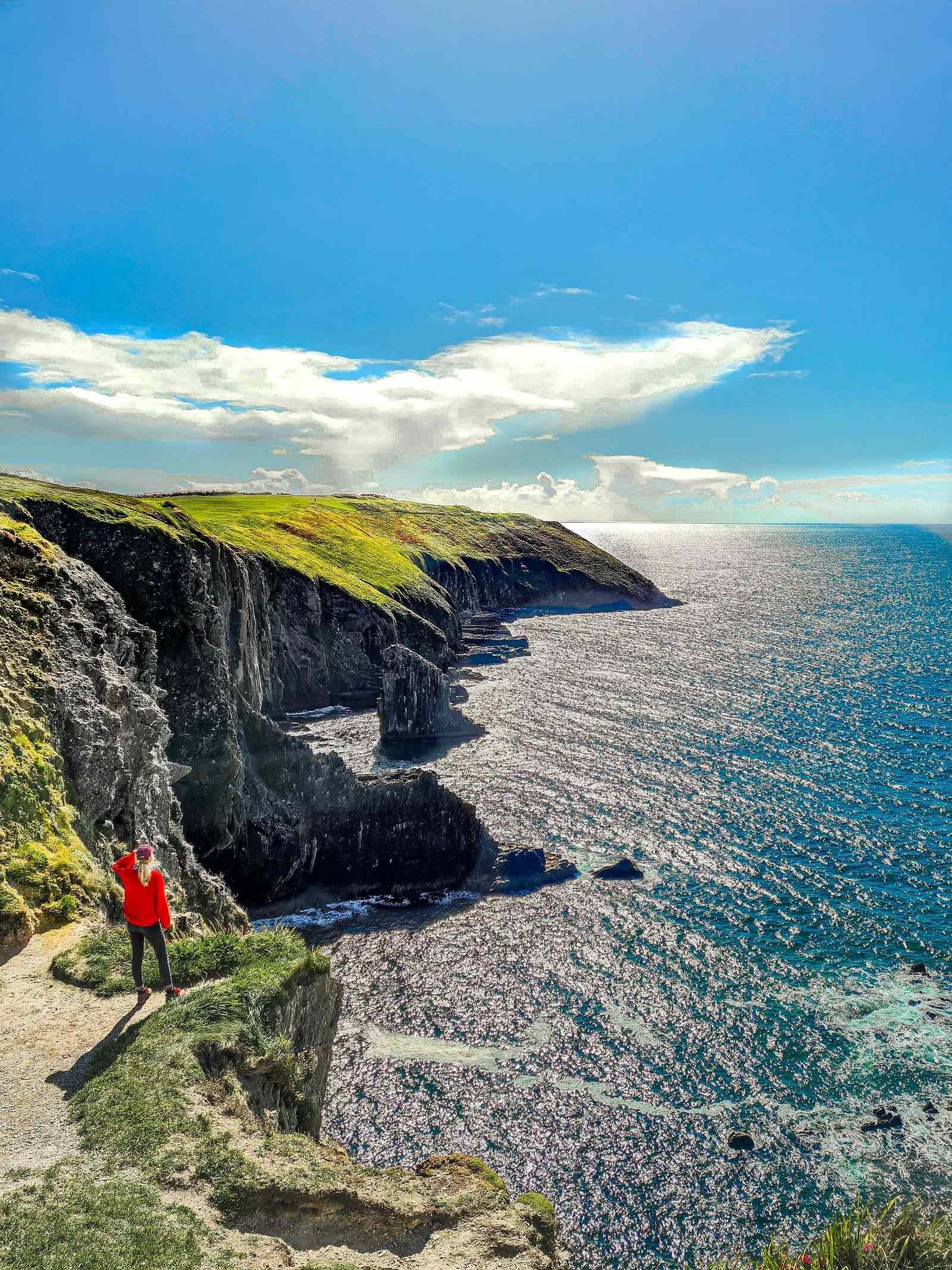
Kilkee Cliffs Walk, Clare
Kilkee Cliffs
Distance: 3.5-4km
Description: Out and back or Loop walk
Difficulty: easy-moderate - a short steep section at one point on the cliffs. Can do the loop clockwise to go downhill on this section making the walk easy
Trail Colour: NA
Start Point: Diamond Rocks Cafe car park / Pollock Holes
Finish Point: Diamond Rocks Cafe car park / Pollock Holes or Kilkee Beach
If you’re looking for an alternative to the Cliffs of Moher but without the crowds, Kilkee Cliffs are the place to be.
These spectacular sea cliffs are situated very unassumingly beside the town of Kilkee in County Clare and the walk along them from the town is popular with local walkers, joggers and dog walkers.
It’s really up to you where you start, if you’re staying in Kilkee itself, you might want to walk from your accommodation to do this route.
You can do the out and back walk just along the cliffs and back, or you can take the path at the end of the cliff walk and follow the road back into town to make it a loop walk.
If you want to start from the beginning of the cliff walk, park at this car park by Diamond Rocks Cafe. This is a large car park but it isn’t named on Google Maps.
From here, follow the trail along the cliffs, it’s a well-marked, gravel path which follows the cliffs edge, there is a short steeper section up to the top of the highest cliff but should be doable for most (I saw grandparents pushing a pram up the hill was was impressive!)
Once you reach the top of the hill, continue a bit further and the path reaches a narrow road/farm track, if you turn left, you’ll be heading back into town and the road will bring you right out on Kilkee Beach.
This is a lovely early morning or evening walk to do and you can make it as long or as short as you like.
Bay Lough, Tipperary
Bay Lough
Distance:2.9km
Description: Out and back
Difficulty: easy
Trail Colour: NA
Start Point: The Vee
Finish Point: The Vee
A lovely drive into the hills and a nice and easy out and back walk to a lake, Bay Lough.
This unique teardrop shaped lake is especially beautiful to see when the purple heather is in bloom around it - usually in the summer months.
Park at the car park at the start of the trail, here on Google Maps. There are no toilet facilities, but there are benches and waste bins.
This is a great family-friendly walk in Ireland, the path slopes down slightly towards the lake and slightly uphill on the return, but the path is flat and easy to follow.
Rossbeigh Loop Walk, Kerry
Rossbeigh Loop Walk
Distance: 8.5km
Description: Loop walk
Difficulty: Moderate
Trail Colour: NA
Start Point: Rossbeigh Strand Beach car park
Finish Point: Rossbeigh Strand Beach car park
This is the longest walk on this list which is the only reason it’s marked as moderate, the walk itself is very doable for anyone of average level fitness.
During our two months in the country, this Ring of Kerry walk was one of the best hiking trails in Ireland during our entire stay.
It’s important to note that this trail we did DOES NOT go over Ross Hill, instead it follows the same starting route along the hill edge but then continues onto Curra Road on the other side of Ross Hill until you loop around and reach the coast again.
If you do want to go up Ross Hill, this route map is good to follow and the distance is slightly over 10km in total.
For this Rossbeigh loop walk, start at the Rossbeigh Strand Beach car park and turn left back onto the road.
Continue until you reach the Glenbeigh Fairy Forest car park and follow the fairy trail up into the woods. This is the only slightly steeper bit but the fairy trail is meant for children so it’s very doable.
Continue on the path, past the end of the Fairy Forest trail and follow the trail as it looks around Ross Hill.
When you reach a tarmacked road (Curra Road) turn right and continue on here until you reach crossroads.
At the crossroads, turn right
Follow this road until you see the Rossbeigh Strand come into sight.
You’ll descend down this road where the lookout over the strand is incredible
At the bottom, the beach car park will be on your left
Killarney National Park - Torc Waterfall, Kerry
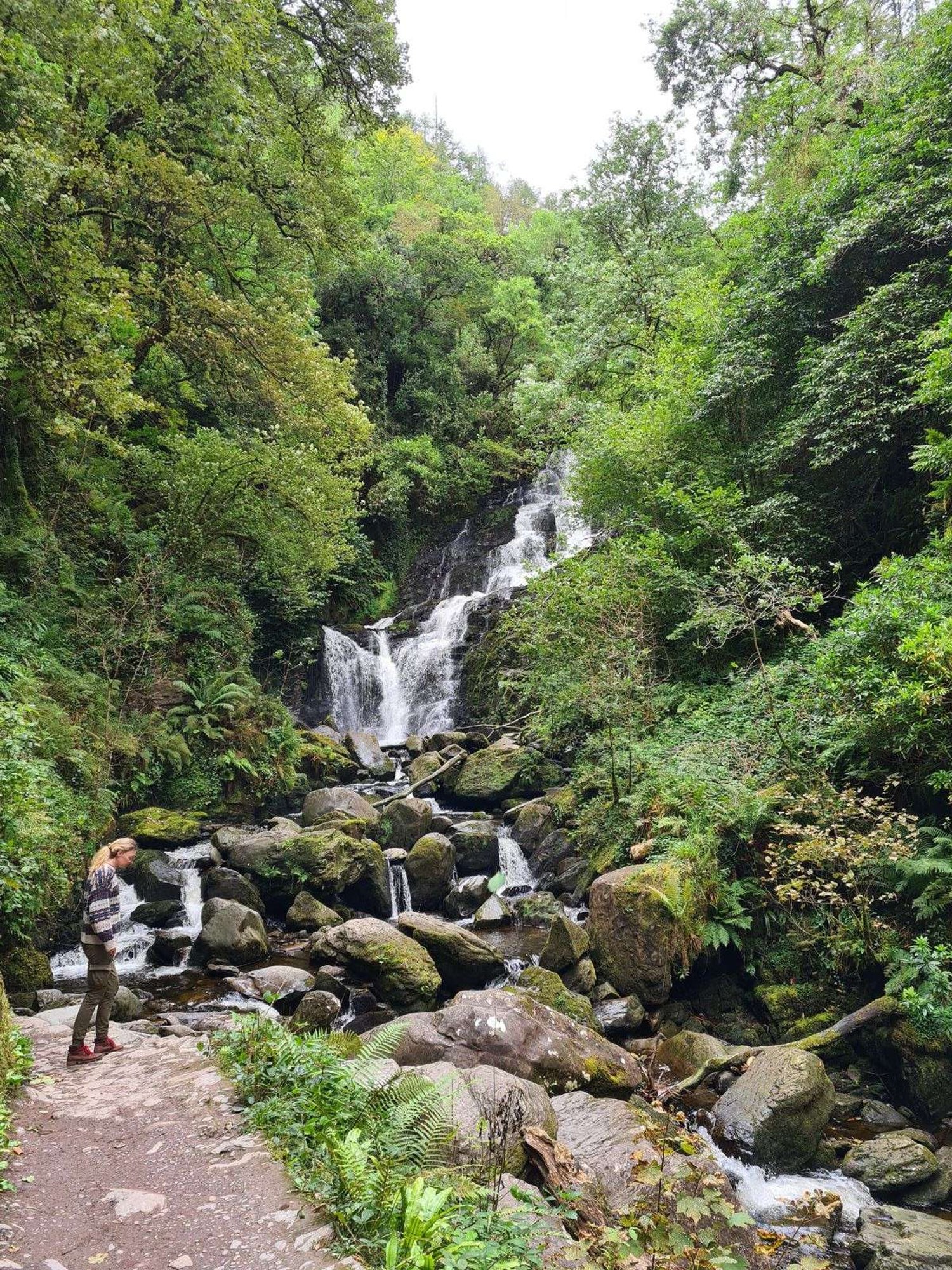
Torc Waterfall
Distance: 2.5km (or 200m if you park at the waterfall car park)
Description: Out and back
Difficulty: easy-moderate
Trail Colour: NA
Start Point: Muckross House
Finish Point: Muckross House
There’s a few options for reaching Torc Waterfall. The most common trail is from Muckross House to the falls, which is a fairly easy, dog-friendly, out and back walk.
Muckross House is just 6km drive from Killarney, the car park has toilet facilities and you can follow a few routes from here around the lakes and Killarney National Park.
The route itself is doable for most average fitness levels however there are steps and you’ll also need to cross the main N71 road, so please look after children and keep dogs on a leash.
Alternatively, you can park at the Torc Waterfall car park just off the N71 and walk 200 metres to the waterfall viewing area.
Or park at the Killarney Hiking Parking Lot which is a much steeper out and pack walk to the waterfall that takes around 20 minutes each way. This car park is the base for hikers doing the Torc Mountain hike.
Old Head of Kinsale, Cork
Old Head of Kinsale
Distance: 6km
Description: Loop walk
Difficulty: easy
Trail Colour: NA
Start Point: Garylucas Beach Car Park
Finish Point: Garylucas Beach Car Park
The Old Head of Kinsale is one of the best easy walks in Ireland because it’s paved the whole way, there’s great free parking and facilities and there’s even a pub at the end of it!
I’ve read some guides that say to park at the pub - The Speckled Door Bar and Restaurant but if you’re not planning to go to the pub I think that’s a bit cheeky and you can still do the same walk but by parking at the Garylucas Beach Car Park which is free and has toilets (opposite side of the road just a bit closer to the beach).
From the beach car park, turn right and walk straight across the t-junction.
Continue along this road until you reach the Old Head Car Park, this is the car park for the Golf Club that sits on the tip of the Head of Kinsale so unfortunately you can’t go further along the coast unless you’re planning to play a round.
But when you reach the golf club, the grassy area in front of you on the road you’ve just arrived on, heads down to the Old Head of Kinsale viewpoint. Be cautious here, the cliffs are unprotected.
Then follow the road round to the left as it loops back on the other side of the peninsula and back towards the start.
Optional stop at the Lusitania Museum & Old Head Signal Tower
You’ll come out on the main road with the Speckled Door Bar pub on your right, turn left and this main road brings you back to Garylucas Beach Car Park.
It can be very open and blustery on the walk and the weather changed very quickly when we were there, sun to torrential rain, to sun again in the time it took us to walk so make sure you have a waterproof and good shoes.
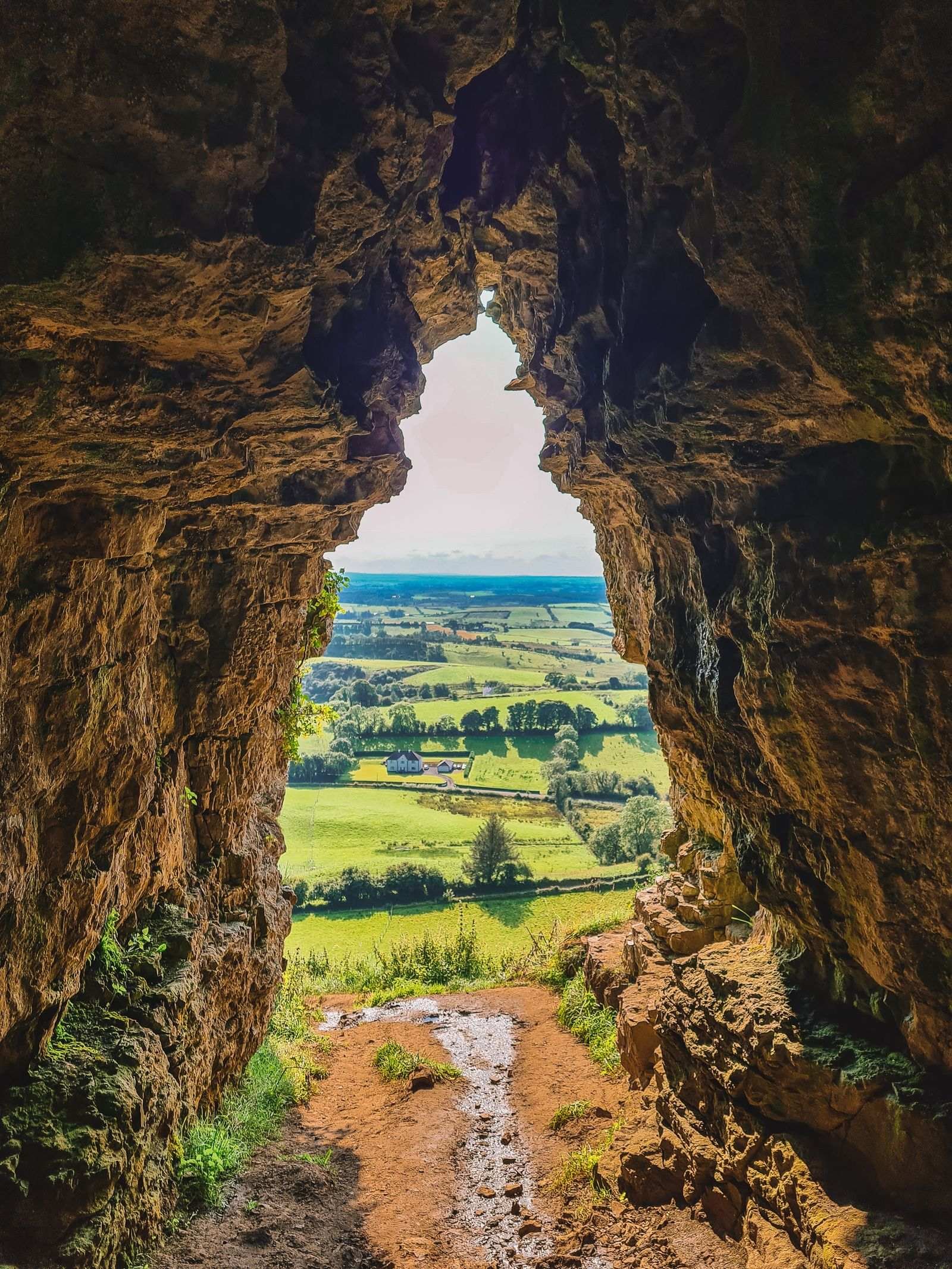
Ballinastoe Woods Boardwalk, Wicklow
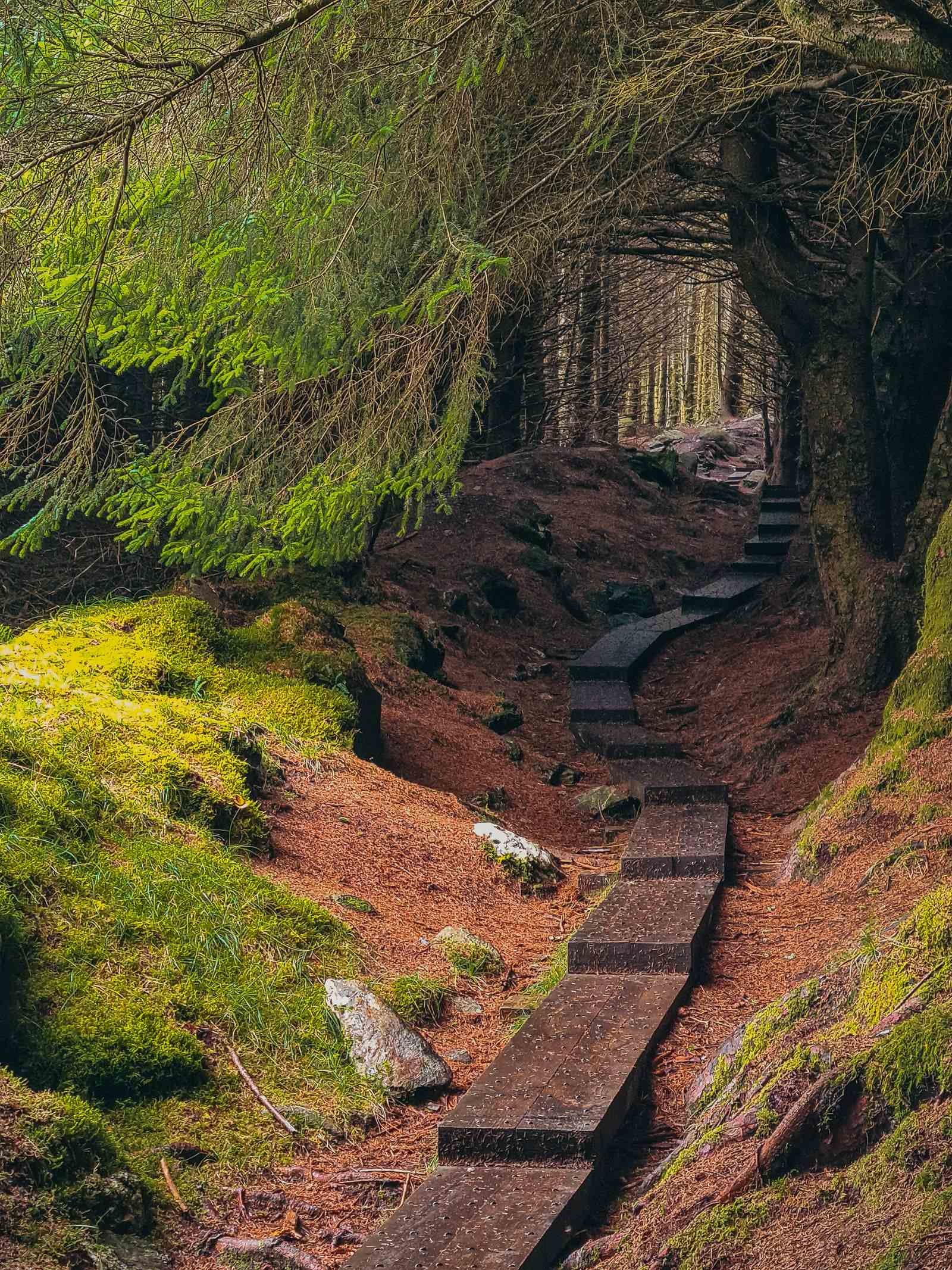
Ballinastoe Woods
Distance: 3.5km
Description: Out and back
Difficulty: easy
Trail Colour: NA
Start Point: Ballinastoe Car Park
Finish Point: Bru Coffee car park ( Can’t find the actual name of it but there’s a coffee pop up here, click the link to see the location)
Ballinastoe Woods is one of the most popular walks in Ireland because the famous boardwalk through the trees looks like a fantastical movie scene, something from Lord of the Rings or Harry Potter. It really is one of the must-do easy walks Wicklow County has to offer!
This is an out and back route but I’ve linked the two possible car parks in the start and finish points above so you can choose which one to start from.
We started from the Bru Coffee car park here - this isn’t it’s actual name but there’s a pop-up coffee truck here called Bru Coffee. This car park appears to only open seasonally, the gates were closed when we visited in late September, but us and a few other people parked in the gravel pull-in or the other just down the road and walked over the style into the car where you’ll find the entrance to the woods.
The entrance from this end starts strangely as you walk through a forested area, look out for deer.
Follow the trail and it will bring you out at the start of the wooden boardwalk where you turn right and follow the trail.
This trail is fairly easy but the wood can be slippery and it is slightly uphill. If you choose to continue on to the Ballinastoe Woods Car Park before turning around, it does get steep in a couple of short areas as you reach the spectacular views at the top of the hill.
Really, you can do as much or as little as you want and turn back when you’re ready if you’re not planning to go all the way to the car park.
If you do continue on, consider going to the J B Malone Memorial for epic views of Lough Tay.
Howth Cliff Walk, Dublin
Distance: 6km
Description: Loop Walk
Difficulty: easy/moderate - around 130m elevation gain, can be rough ground in places
Trail Colour: Green
Start Point: Howth Village DART (train) station
Finish Point: Howth Village DART (train) station
One of the most popular easy walks near Dublin, Howth Cliff Walk offers beautiful nature, coastal views and easy-to-follow trails for an escape from the city.
The easiest route and the most common route to follow is the Green trail. Starting from Howth Village train station, you turn left and follow the cliff path. As you follow the route, you’ll see the white lighthouse on the tip of the peninsula.
Once you reach the path on your right towards the Summit Car park, you loop back around and follow the inland path back towards the start.
Alternatively, you could park at the Summit Car Park and do the same loop walk from a different start point if car parking at the train station is limited.
The route is popular and does get busy at times, but this is a great family friendly, easy hike near Dublin and it’s also dog friendly.
Summary: Easy walks in Ireland
There are countless easy walking trails Ireland has to offer, you’ll find routes and public footpaths all over the country.
These are the top, easy walks I did during my stay in Ireland and I’ve tried to include at least one in all the popular tourist areas, so you can easily include one on your trip.
Ireland is famous for its dramatic cliffs and mountains, but there are plenty of walks to enjoy and soak in the stunning Irish landscape without having to climb a mountain. Enjoy!
Pin this for later to plan your future trip!